


Bush River Voting District, Newberry County, South Carolina
About
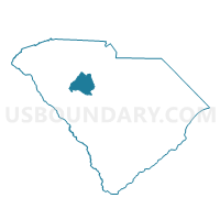
Outline

Summary
| Unique Area Identifier | 666395 |
| Name | Bush River Voting District |
| County | Newberry County |
| State | South Carolina |
| Area (square miles) | 44.83 |
| Land Area (square miles) | 44.71 |
| Water Area (square miles) | 0.13 |
| % of Land Area | 99.72 |
| % of Water Area | 0.28 |
| Latitude of the Internal Point | 34.31237410 |
| Longtitude of the Internal Point | -81.78839270 |
Maps


Graphs
Select a template below for downloading or customizing gragh for Bush River Voting District, Newberry County, South Carolina


Neighbors
Neighoring Voting District (by Name) Neighboring Voting District on the Map
- Chappells Voting District, Newberry County, SC
- Cross Hill Voting District, Laurens County, SC
- Hartford Voting District, Newberry County, SC
- Helena Voting District, Newberry County, SC
- Joanna Voting District, Laurens County, SC
- Kinards-Jalapa Voting District, Newberry County, SC
- Silverstreet Voting District, Newberry County, SC
Top 10 Neighboring County Subdivision (by Population) Neighboring County Subdivision on the Map
- Newberry CCD, Newberry County, SC (18,696)
- Cross Hill CCD, Laurens County, SC (5,445)
- Whitmire CCD, Newberry County, SC (3,351)
- Joanna CCD, Laurens County, SC (2,427)
- Chappells CCD, Newberry County, SC (1,084)
Top 10 Neighboring Unified School District (by Population) Neighboring Unified School District on the Map
Top 10 Neighboring State Legislative District Lower Chamber (by Population) Neighboring State Legislative District Lower Chamber on the Map
- State House District 40, SC (34,899)
- State House District 14, SC (33,392)
- State House District 15, SC (30,253)
Top 10 Neighboring State Legislative District Upper Chamber (by Population) Neighboring State Legislative District Upper Chamber on the Map
- State Senate District 18, SC (95,143)
- State Senate District 9, SC (95,114)
- State Senate District 10, SC (84,695)
Top 10 Neighboring 111th Congressional District (by Population) Neighboring 111th Congressional District on the Map
Top 10 Neighboring Census Tract (by Population) Neighboring Census Tract on the Map
- Census Tract 9507, Newberry County, SC (4,028)
- Census Tract 9503, Newberry County, SC (3,351)
- Census Tract 9210.02, Laurens County, SC (2,667)
- Census Tract 9209, Laurens County, SC (2,427)
Top 10 Neighboring 5-Digit ZIP Code Tabulation Area (by Population) Neighboring 5-Digit ZIP Code Tabulation Area on the Map
- 29108, SC (20,469)
- 29325, SC (15,222)
- 29370, SC (1,045)
- 29145, SC (837)
- 29037, SC (824)
- 29355, SC (810)